As I have been exploring the area round Cruden Bay, one question keeps coming into my mind: did the Water of Cruden always flow into the sea between the beach and the harbour? Some research with old Ordnance Survey maps (fortunately available on line at the National Library of Scotland Website) always shows the burn flowing along its current line under the Ladies’ Bridge and into the bay.
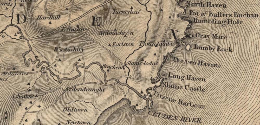
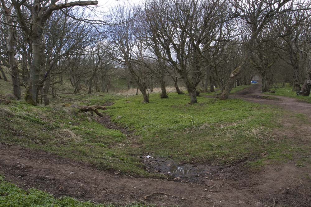
The question first occurred to me when I was photographing the bridges which cross the Water of Cruden. I came across a reference in The Ordnance Gazetteer of Scotland: A Survey of Scottish Topography, Statistical, Biographical and Historical (edited by Francis H. Groome (1882 to 1885)). Two burns feeding the Water of Cruden are mentioned: the Burns of Lacca and Gask. I have identified Lacca (which is now marked Laeca on the maps) joining the Water of Cruden near Midmill. But I can find no reference to the Gask burn. Might the burn which flows through the Castle Woods and down through the gorge to the sea, a little way to the north of Port Erroll harbour be the missing burn? It certainly flows through Gask, a little to the north-east of Longhaven. As it flows towards the sea, it has carved a deep gorge into the rocks between the Donnons and the flat cliff top area leading to Port Erroll. It occurred to me that such a significant feature really ought to have a named burn flowing through it.
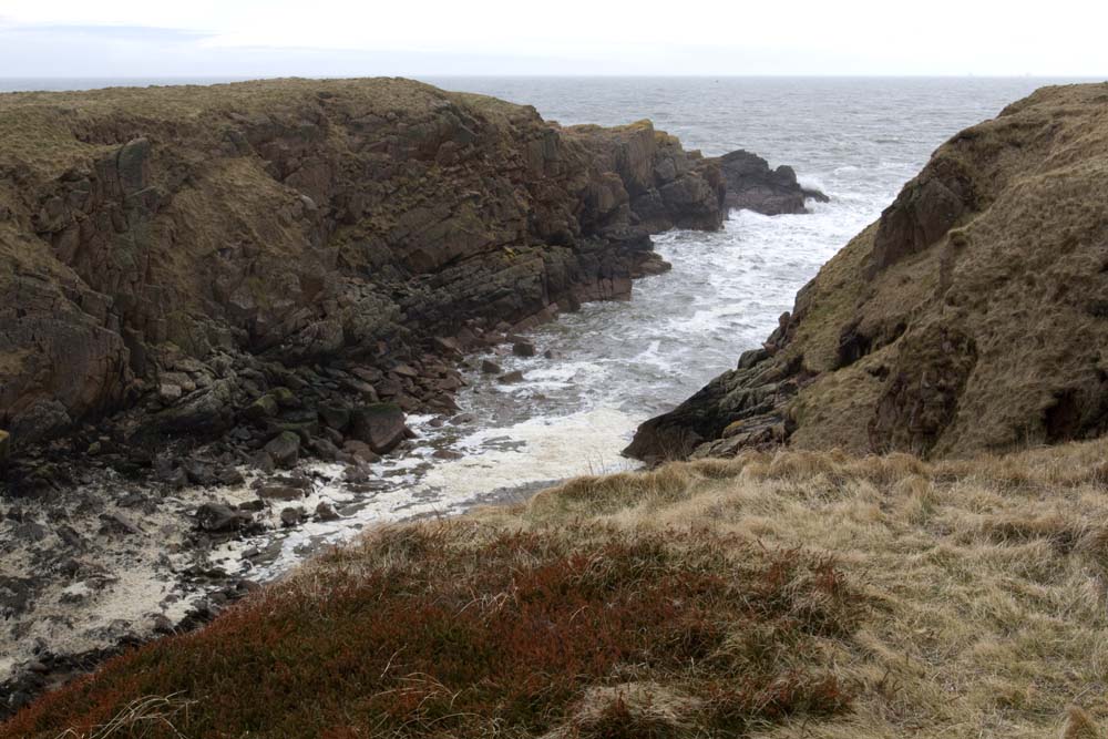
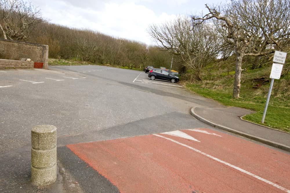
An examination of the large scale OS maps told me the gorge did have a name: Old Water Moo’. Might the Water of Cruden once have flowed into to the sea through this gorge? The reference to “Old Water Moo'” might indicate a “former” mouth. It would not take much to divert the burn at the point where it passes the Congregational Church, through the car park – and you are there! But what about proof?
Well here is my evidence.
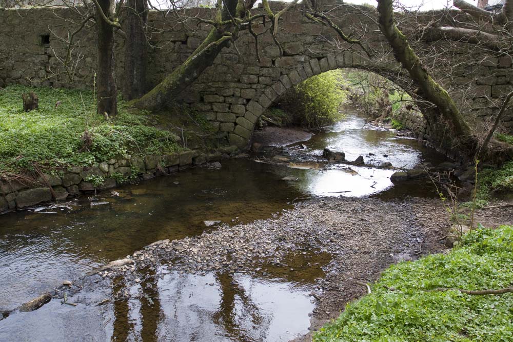
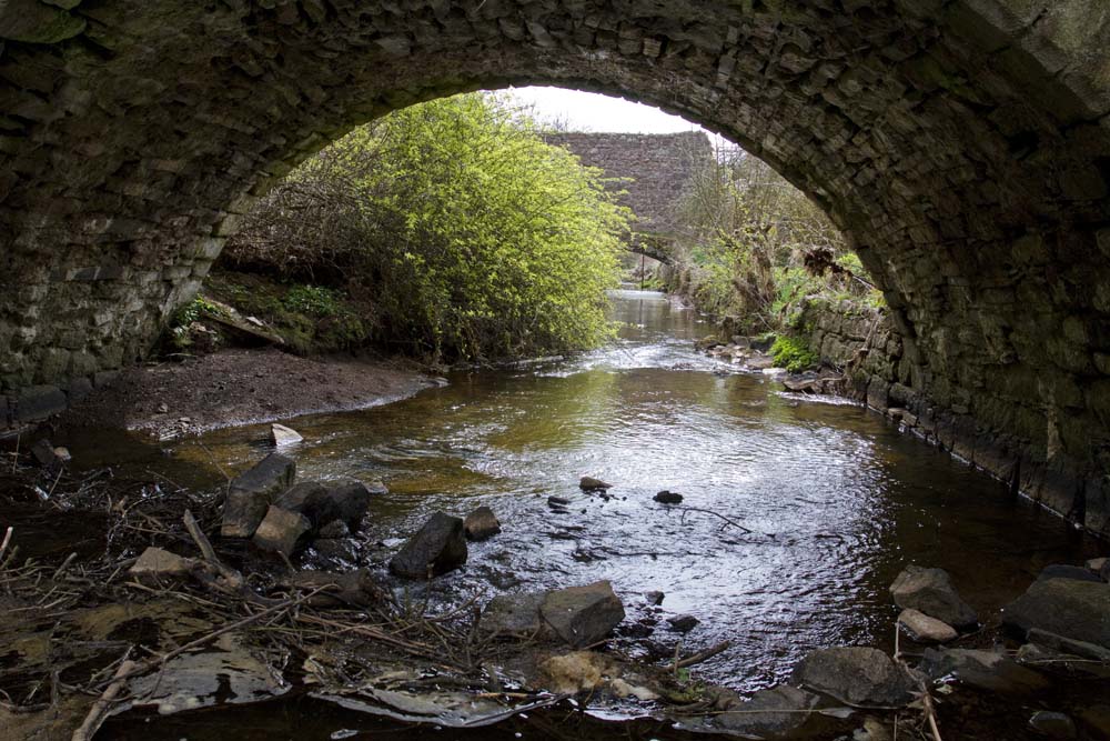
First. Historic Scotland lists the bridge at Castle Road, at Bridge House (B Listed Building) in these words:
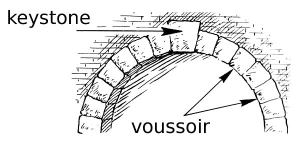
SLAINS CASTLE DRIVE, BRIDGE OVER WATER OF CRUDEN AT BRIDGE HOUSE – Early 18th century or possibly earlier. Long approaches with 4 arched recesses each side on S. Single arch with dressed and chamfered voussoirs. Coursed granite rubble. In poor condition. Parapet at N. decayed.
The burn crossed by the bridge is certainly not the Water of Cruden, but did this burn once flow into it?
Second: Rev Alexander Cock, writing in the First Statistical Account (1791-99) said:
If the small brook previously mentioned [Water of Cruden] could be carried into the sea at Ward [the area now called Port Erroll] and a harbour made out, that could receive small vessels which might lie in safety at all seasons (of which there appears to be the highest degree of probability) a flourishing village would be the certain consequence………were the Earl of Errol to employ a small sum annually in carrying forward such improvements as the situation of the parish points out……….he would not only have the glory of improving and beautifying a large tract of country but the satisfaction of being proprietor of one of the finest pieces of property in the North of Scotland.
So it seems that the main flow of the Water of Cruden up to the 1790s did not follow the present route into the bay.
Clearly this matter was very much in Mr Cock’s mind as he penned his article for the Statistical Account. He comes back to the same subject again:
It appears very probable that a tolerable harbour could be made out at Ward………..If a small brook which passes along the S. end of the Earl of Errol’s gardens were introduced into the sea at the end of the beach, next the Ward there is every reason to believe that a very safe landing place could be made for boats or larger vessels and perhaps it might be the means of forming a very valuable salmon fishing.
(University of Edinburgh, University of Glasgow. (1999) The Statistical Accounts of Scotland 1791-1799. Available from: http://edina.ac.uk/statacc/ )
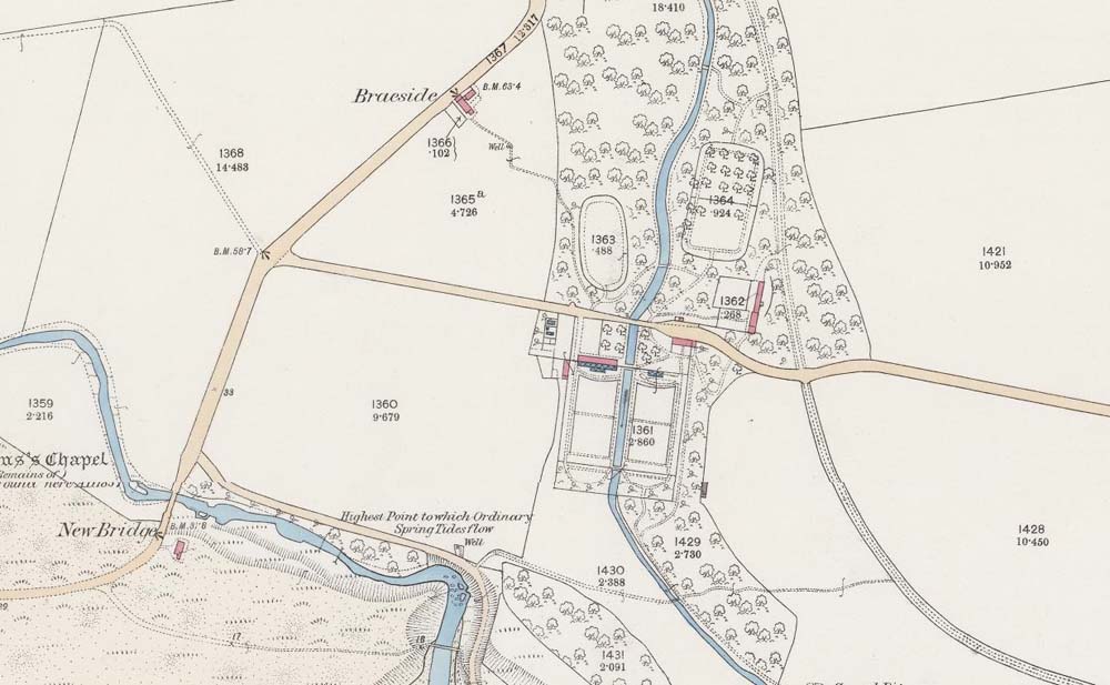
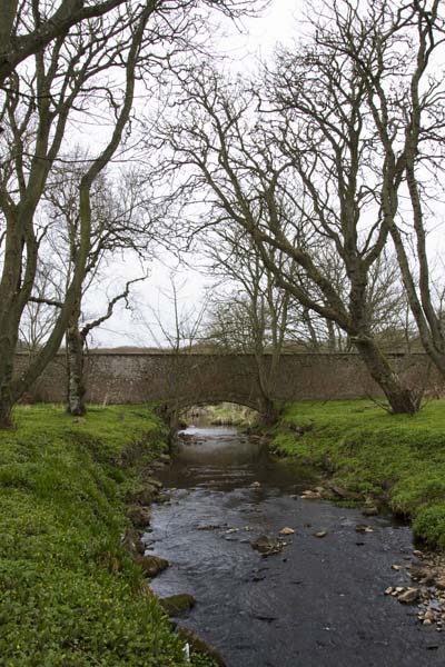
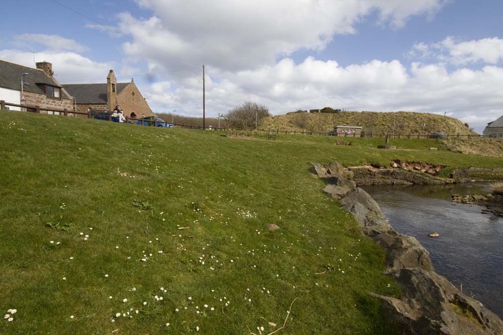
The walled garden is there, and where the burn flows through the woods and under the bridge, the old maps indicate gardens too. (Incidentally I love the arched bridge features at either end of the Garden wall through which flows the burn. A most unusual arrangement.)
This must be what Mr Cock is talking about. The south end of the garden would put it about where the Port Erroll car park now stands. I can imagine the Water of Cruden turning to the left about where the Congregational Church is now situated, being joined by the Gask burn which flowed through the garden, and from there on to the sea at the Old Water Moo’.
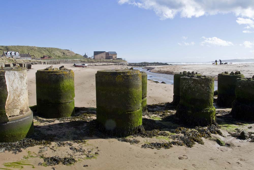
The present Port Erroll Harbour was built with a contribution of £14,000 from William Harry Hay the 19th Earl of Erroll in 1875. Clearly the pleas of Mr Cock were heard, although it was nearly a hundred years for the harbour to be completed. [Read more about the Port Erroll Harbour] I am assuming that at some time in the early part of the 19th Century the Water of Cruden was rerouted.
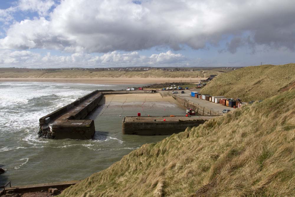
Third: the 1868 and 1899 surveys of the area by the Ordnance Survey show the burn flowing along its present route. This gives us 1868 as the cut off date.
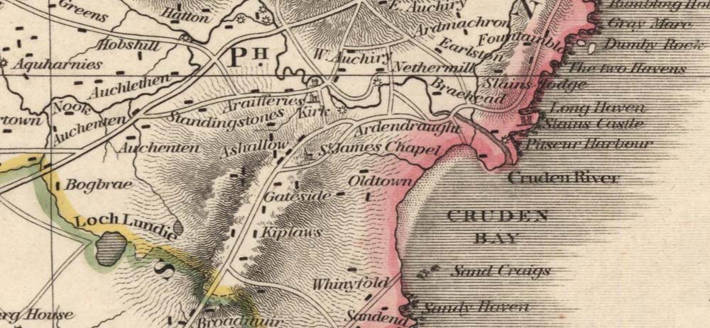
However an earlier map (James Robertson, Topographical and Military Map of the Counties of Aberdeenshire Banffshire and Kincardineshire 1822) tells a different story. The main channel of the Water of Cruden flows out through the Old Water Moo’; the Gask Burn joins it. A small stream is shown flowing out of the Water of Cruden and on to the sands along the current route. Thomson’s Map of 1820 shows the same. Just what Mr Cock described.
(All the old maps I consulted are available on the National Library of Scotland Website.)
So have I found the missing Gask Burn? Did the Water of Cruden once flow through what is now the car park and out to the sea a Old Water Moo’? Did some significant civil engineering take place in the early part of the 19th Century (before 1820) to reroute the Water of Cruden and help the eventual development of Port Erroll Harbour? I am not able to find any direct reference to this, but I am fairly sure of my conclusion from an examination of the evidence.
Can anyone tell me more? Am I right or is there is a different story to tell? I do hope that someone has some information, or is able to point me to someone who knows the answer.
Think you are correct with your assumption. I have an old photograph which would appear to have been taken at the time of the diverting of the burn,